Volumetric Works and Quarry Services
Professional land survey services in Dundee and throughout Scotland.
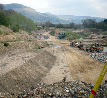
Volume calculation services
Volume calculations are carried out by initially undertaking a full topographical survey of the particular development site or quarry area, using electronic distance measurement (EDM) or global positioning (GPS) equipment.
Survey works are then processed on dedicated workstations using specialised modelling software developed by AIC, which allows accurate three dimensional ground models, quarry profiles or stockpile volumes to be calculated.
The calculations can be carried out in a number of ways, from simple model projections from a horizontal or inclined datum to more complex combinations of several three dimensional ground models.
Volumetric analyses
The data presentation and volumetric analysis can be output in a variety of formats in order to highlight individual cut / fill or stockpile volumes and cross sections can also be generated, to give a visual complement to the computer generated volumetric analysis.
This service allows developers and designers to quantify cut/fill volumes for a particular development and also allows quarry managers to know exact stock levels, rates of production and remaining quarry capacities.
Contact us
today for any aspect of your volumetric survey requirements.
For all your volumetric survey requirements, call our team in Dundee on
01382 541 333